In San Martín de los Andes the trekking is an activity that has many followers, since it is a destination that offers trails wrapped in a magical natural environment. Volcanoes, hills, forests, lagoons and lakes open through the different routes that there is to do and the vast majority are accessible from the city.
In this article you will find a guide to all the hiking circuits that can be done in this mountain paradise:
Mirador Bandurrias

It is one of the most popular trekkings in San Martín de los Andes, it can be done throughout the year and the difficulty is low, since it is a 5-kilometer walk that takes approximately half a day.
The path to the Bandurrias viewpoint starts behind the effluent treatment plant, at the end of Juez del Valle street, in the area of the Costanera del Lago Lácar. From this point there are signs that mention the viewpoint and a gate that will indicate that you are entering the lands of the Mapuche community.
The path is wide with a gentle slope, it is a pedestrian path that enters the forest. The march is continually uphill. During the tour you will find a variety of fauna accompanied by cypresses, radal, oak and coihue.
Once at the Bandurrias viewpoint you will have one of the best views of the city, Cerro Chapelco, Cerro Abanico, the beaches of Catritre and Quila Quina, and all the Lake Lácar.
From the Bandurrias viewpoint you can also access the Islita viewpoint, where you can also enjoy beautiful panoramic views. To get to this other viewpoint it is a few kilometers along a path (Islita) that departs from Bandurrias (it is signposted).
Cerro Acol
The adventure begins from San Martín de los Andes heading west, bordering the Lácar, Nonthué and Queñi lakes. After a journey along the provincial highway 48 of 1.5 hours will arrive at the base of the Acol hill, located very close to the border between Argentina and Chile.
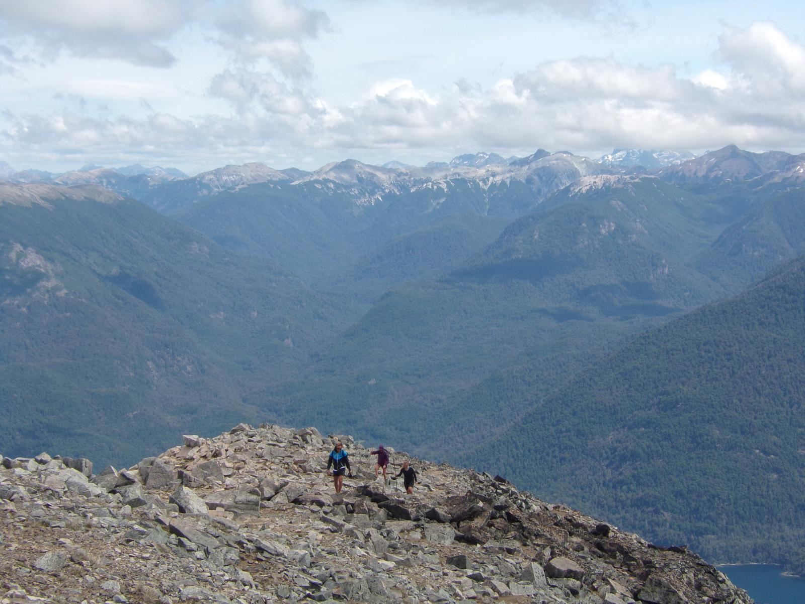
From the base of the hill the trekking route will begin, which will be of medium difficulty. The walk is 7 hours long and 11 kilometers in total, it will have place through different stages in which they will reach a slope of 1000 meters. The first section of the route through this beautiful area of the Lanín National Park will pass through raulí and caña colihué forests.
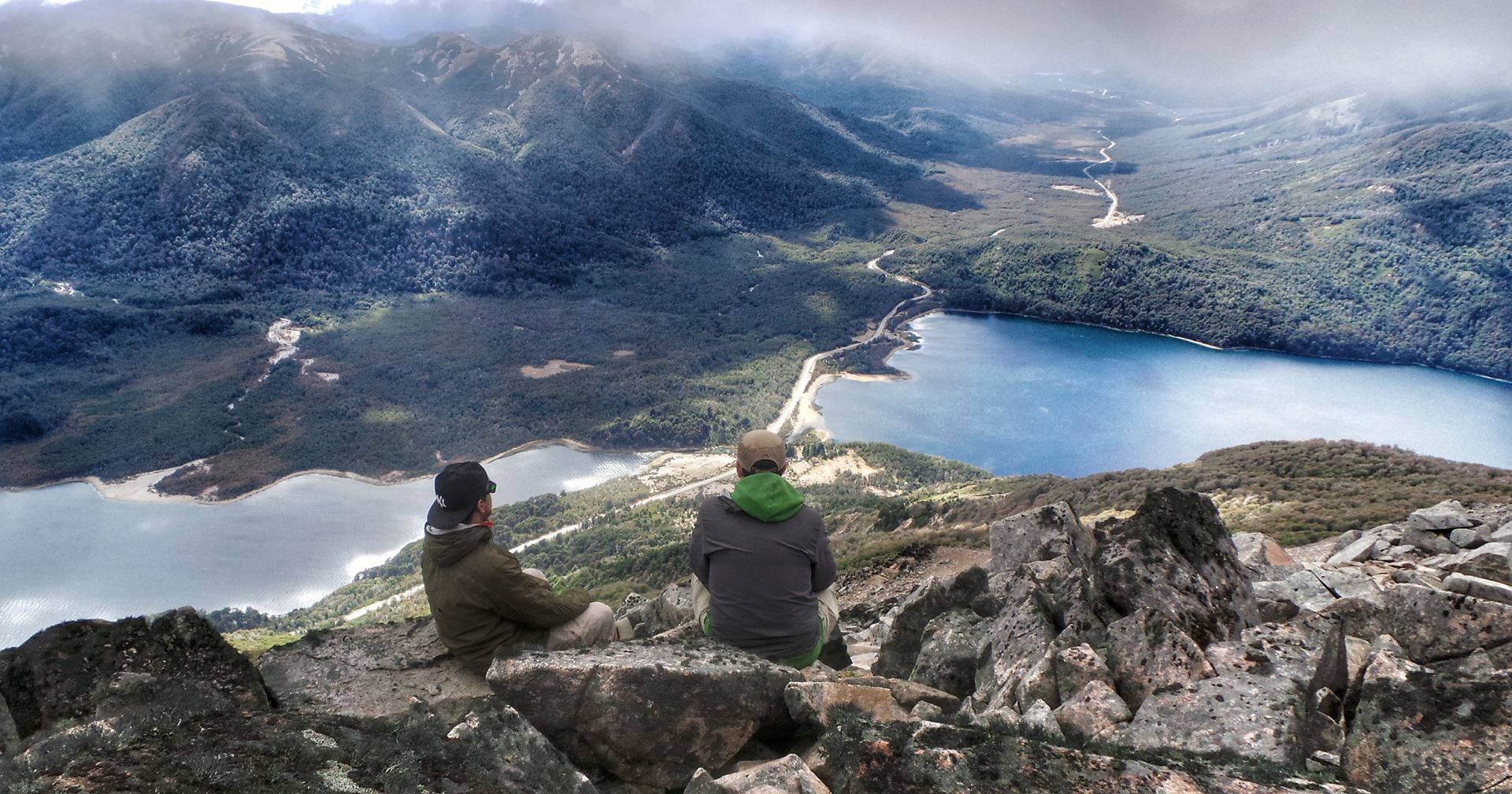
Next, they will cross areas of lengas until they reach a viewpoint where they can stop and take pictures. The route will continue to the summit of Cerro Acol, located at 1844 meters above sea level. There is space to have a picnic to recharge your batteries while enjoying the views of the Chilean mountain range and the Queñi, Nonthué and Lácar lakes.
Cerro Mallo
The Mallo hill is one of the most emblematic peaks of the Lanín National Park . To do the trekking I recommend you leave San Martín de los Andes early to have all day, since the ascent is of medium difficulty and can take around 10 hours.
The hike begins 45 minutes from San Martín de los Andes along the RP 48 towards Hua Hum. The trekking path (Cerro Mallo) ascends by the mountain within a mixed pellín, coihue, raulí and lenga oak forest that in the highest part becomes squat due to the height and weather conditions.
The prize is at the top, because the view is impressive and you can see the Lanín, Villarrica, Quetrupillán and Choshuenco volcanoes, as well as Lake Queñi.
The unevenness to overcome is about 1,200 meters, the trek is uphill without steep slopes. It is advisable to do this circuit from November to May.
Cerro Chapelco
Chapelco hill is located 19 kilometers from the city of San Martín de los Andes. Although the greatest activity is concentrated during the winter season, the easy access and its proximity to the urban area make it a highly recommended tourist destination the rest of the year.
The circuit begins by taking national route 234 (Route of the Seven Lakes) to, after five kilometers enjoying the views of Lake Lácar, find On the right the entrance to the Catritre spa (an extensive bay with sandy beaches, an organized campsite, a wild campsite, restaurant and picnic area) and one kilometer further on, also on the right , the detour that leads to Quila Quina.
Continuing along the path that runs parallel to the national route, approximately 15 kilometers away you will find, on the right bank, the Mirador del Pil Pil , the perfect excuse to stop and appreciate an unbeatable view of the entire valley of the homonymous stream, the lake and the mountains.
Just one more kilometer and, on the left, you will find the provincial route 19, gravel road, which leads to the winter center.
A continuous ascent, between melting streams and the lenga forest, allows us to appreciate all the magnificence of the Patagonian landscape, while, to the right and after five kilometers of travel, the slopes begin to appear , lifts and buildings in the complex.
The parking lot, located about 1200 meters above sea level, is an unbeatable natural balcony from which you have a wonderful panoramic view of Lake Lácar with the mountain range in the background and the eternal snow cone of the Lanín volcano.
From there you can start a 5-kilometer walk (or take the cable car to platform 1600), and walk around the surroundings to enjoy the silence and beauty of the forest.
Chapelco is one of the most exclusive places in the country for its modern ski center , with slopes of varying degrees of difficulty for beginners, intermediate and expert skiers. complemented by a sufficient number of lifts that allow quick access to them, to the shelters, and confectioneries in the complex. In summer the hill offers other options framed within adventure tourism, trekking and a slide park for children and adults.
To return to the city you can go down the route that, between ñires, corrals and flocks of sheep, leads to Puente Blanco, crossing lands of the Mapuche community.
Colorado Volcano

E is one of the most visited, both for reaching the summit and for practice prior to other more difficult ascents.
The journey begins at the foot of the Colorado (40 minutes from the city) in front of Piedra de Trompul, an emblematic rocky promontory of about 800 meters above sea level within Mapuche territory. The path (Colorado) to the volcano begins in a small forest next to Route 48. From afar you can see the summit that stands out for its conical shape and for the red color of the volcanic material that makes up your soil.
During the way you will cross the stream that comes down from Cerro Colorado and on the right side of the canyon you can see the footprint to start the walk of 1,000 meters of unevenness that exist between foot and the top. The duration of the trek to reach the maximum point is approximately two and a half hours at a medium pace.
As they go they will cross lengas forests, in the first section they have firm and erect trunks but as they go up They lose their shape. When they exceed 1,500 meters above sea level, it can be seen that the lengas are squat as a result of the continuous snowfalls that modify their structure due to the weight and time that they cover them.
The leaves of the lenga and ñire in autumn turn their color towards an intense reddish and coppery, and offer a very showy mountain to contemplate or photograph.
Near the top, you will probably have to do a few meters with some snow. These ascents are made from October to November, you have to provide gaiters, waterproof ski pants and poles (they can be supplanted with reeds found on the route) as part of the equipment.
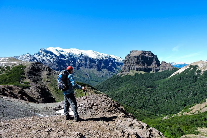
Upon reaching the top, the ground is of an intense red color formed by stone of volcanic origin. From this great vantage point you will be able to appreciate Lake Lácar, Lolog, the mountain range of Chapelco, the hills Abanico, Sabana, Mallo, the Lanín volcano and the immense Andes mountain range that shows some of its snowy peaks.
To get to the Colorado volcano, first you have to start from its base and you can go renting a car from San Martín de los Andes along National Route 234 towards Junín de los Andes and after 3 kilometers take National Route 48 to the left. After traveling 7 to 8 kilometers along gravel road, you cross the Pampa de Trompul and then the Piedra de Trompul. In front of the latter there are indicative signs that mark the beginning of the route to the Colorado volcano.
Another option and the most recommended is to do the trekking excursion to the Colorado volcano. The ascent takes an average of 3 hours with transfers included from the city.
Achen Niyeu Volcano
To start the trek at Ñiyeu Volcano you must go from the City of San Martin de los Andes by vehicle (2 hours from Route 40) to Laguna Verde , where you will take the Andean Footprint path that goes to the Auquinco valley until you reach at the base of the Achen Niyeu: a majestic volcano of the Huanquihue massif, belonging to the Lanín National Park.
The landscape s of this Argentine natural space, bordering Chile, will captivate you!
The hike, which will have a medium difficulty , will pass through almost lunar landscapes of the northeast slope of the volcano with a drop of 750 meters. The effort will be worth it. It is worth it, since after a 6-kilometer and three-hour journey you will reach the top of Achen Niyeu. From this summit, located at 1716 meters above sea level, you will contemplate amazing panoramic views of the crater, the Lanín volcano and the Auquinco Valley.
The Achen Niyeu volcano had its last eruption 1000 years ago. The huge lava spill reached the Lake Epulafquen, which you can also observe from the highest part of the peak.
After recharging energy and resting on the summit, you can descend the 6-kilometer trail that is marked as the base of the Achen Niyeu. In this new hiking route you will know some characteristics of the volcanism of the province of Neuquén . Finally, from the base of the volcano you will be able to return around the city.
Laguna Las Corinas
This is a circuit that runs through the heart of the humid forest, visiting hidden lagoons among the vegetation. It is ideal to do as a family due to the shortness of the route and its level of low difficulty.
To begin this tour, you must travel by car along provincial route 48 that leads to the Hua Hum international pass, up to Yuco (35 kilometers from the city). The path to Las Corinas lagoon begins on the right margin of the path.
The beginning is a continuous climb that goes into a variegated forest where ferns, mosses, and a lot of humidity abound. There are precarious signs on logs; the one with number 3 opens a small, optional detour to the right that leads to another particular lagoon, called Los Coipos. It involves an additional half hour, but it's worth it.
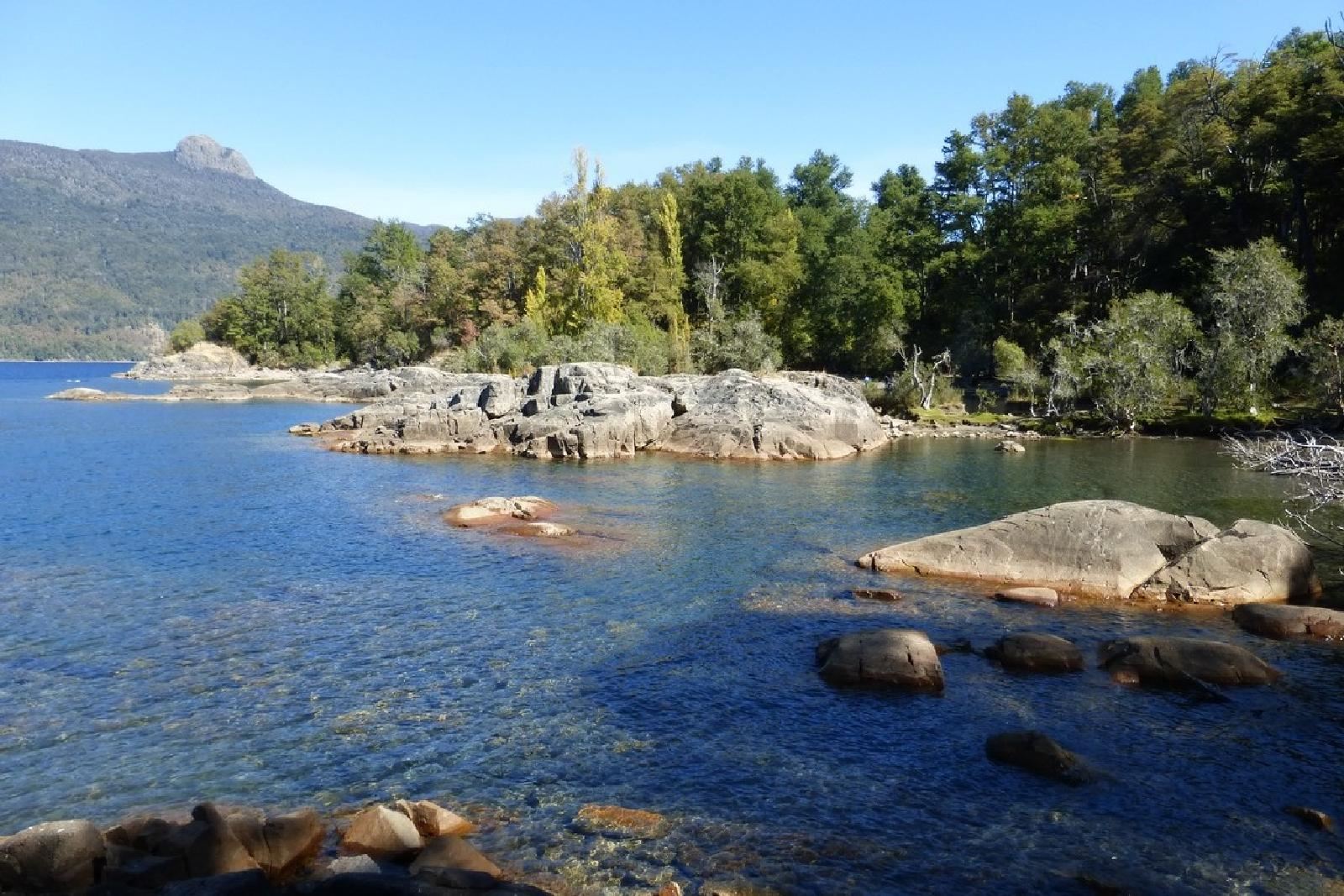
Half an hour more of walking and you will find the Corina Grande lagoon, almost hidden on the left between the forest and the coihues reeds, here you will be able to sit on the rocks and enjoy all the natural surroundings.
If you want to know the Corina Chica lagoon, it takes another fifteen minutes of walking , and to find the path you have to go back to the point identified with the number 6 and take right. Be careful because the beginning of this trace is not as clear as the main one.
A short ascent, and then the path descends to the lagoon, smaller than the previous one but equally attractive and magical. The return is made by the same path used to get there.
Laguna Rosales
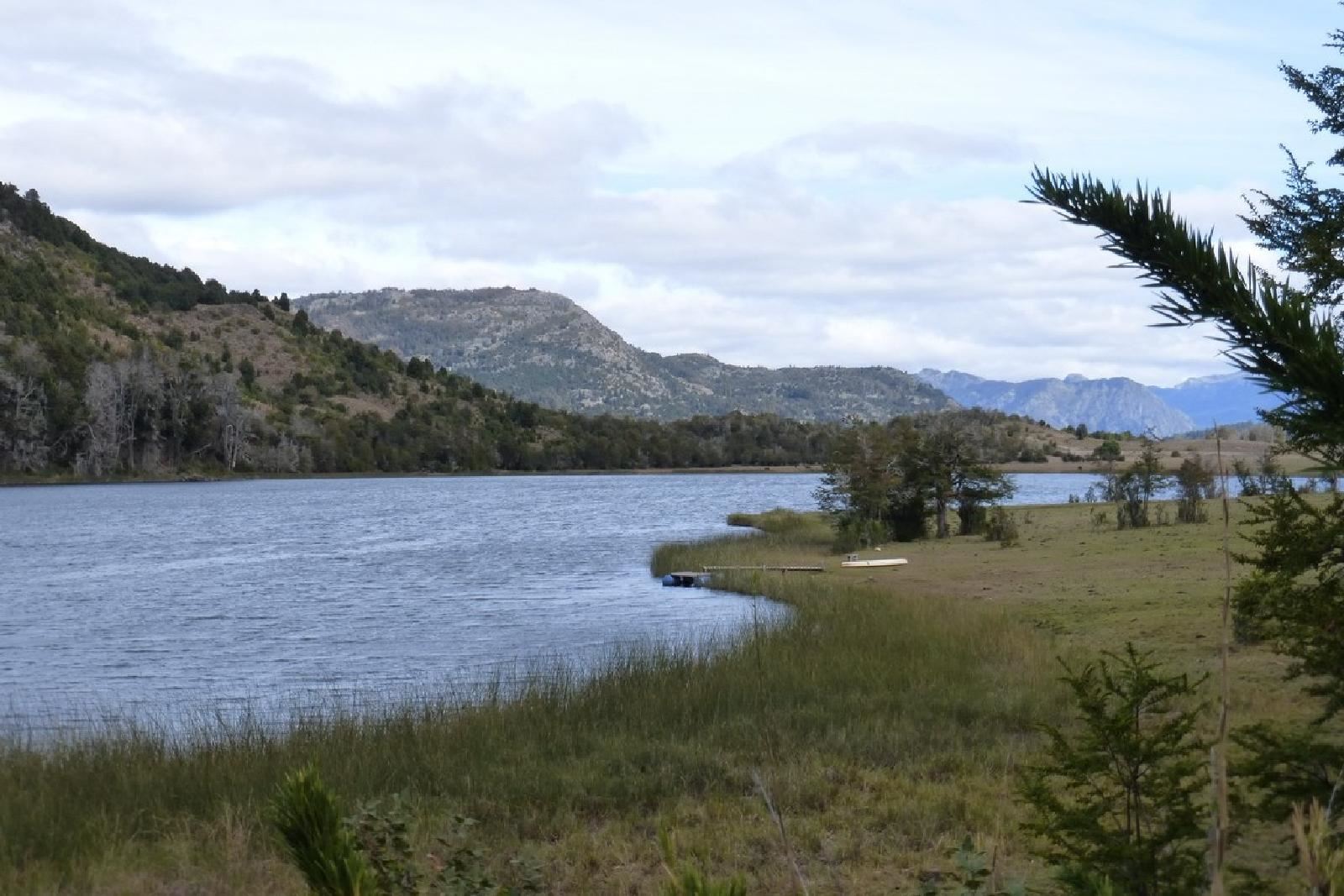
The trekking to Laguna Rosales is a very interesting option for bird watchers and nature lovers, since they can discover a very attractive site located a few kilometers away from the city.
Laguna Rosales is located approximately 7 kilometers from the center of the city, it can be reached through the path parallel to route 62 that leads to Lake Lolog, where you will see a sign indicating the path to the lagoon.
It is a characteristic area of the transition between the steppe and the forest , surrounded by a natural environment where trees such as ñires, coihues, maitenes and radales among others along with the lagoon, they are the refuge of the birds that live there.
From the access gate, until you reach the lagoon, you travel a path of approximately 3 kilometers, which gradually leads you into the Andean Patagonian forest.
Once in the lagoon, you will find two options. Going along the north or south bank, both end in a mallín that is generally impassable because it is flooded.
During the walk you will find the following birds: Chucao, Huet Huet, Rayadito, Colorado Falcon, Common Tero, Real Cauquén, Common Cauquén, Patagonian Comesebo, Rara, Pato Barcino, Duck Maicero, Pato Colorado, Gallareta red league, Huala. It is worth paying attention and seeing the varieties that make up this beautiful corner of San Martín de los Andes.
Lago Escondido
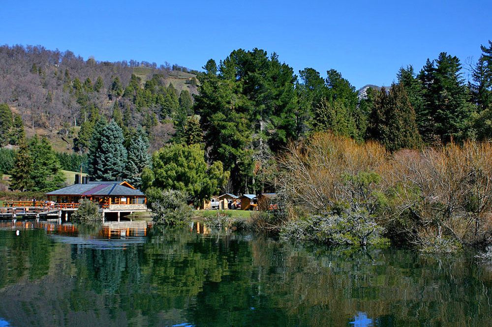
The start of the footpath to Lago Escondido is located a few meters from Villa Quila Quina , more precisely next to the Asociación de Fomento Rural Curruhuinca.
Recommended arrive by car From the city center it is 14 kilometers to the path that covers a distance of 26 kilometers on foot (approximately 9 hours round trip).
At the beginning of the tour you will walk through the lands of the Mapuche community , observing their homes, animals that they take to the high part of the mountains to take advantage of the excellent pastures of the highlands, you will cross small streams of thaw, a compact forest of oaks, waterfalls, and flowered meadows.
After a kilometer you will find a fork where you must continue to the right alternating gentle ascents and descents, until you come across a huge log bridge over a stream.
A new short ascent, a gate and to the left a rural town. A new gate and then a rapid descent until reaching the ford over the Grande stream.
Then there will be five kilometers of ascent and you will see a sign that indicates, on the right, the detour to Ruca Ñire/Pucará, one of the most spectacular trekking trails in the region, heavily traveled by foreigners , which links these places with the hot springs of Lake Queñi and Hua Hum, requiring between three and five days of walking.
You must continue along the vehicular path after a kilometer of a demanding ascent, the descent to Lake Escondido appears, a small water mirror with a beautiful beach and reeds that appear on the surface.
The area is free camping, so it is also an excellent option to spend the night in this wonderful corner of Patagonia.
If you want to know more about San Martín de los Andes and the excursion that you can do, contact us.