
The Seven Lakes Route is one of the most beautiful drives in Argentine Patagonia, perfect for exploring by car, bicycle, or on excursions. This section of National Route 40 winds through Andean forests, past scenic viewpoints and along the shores of turquoise and green lakes , between Villa La Angostura and San Martín de los Andes in the province of Neuquén.
If you're starting from Bariloche , the total distance to San Martín de los Andes is about 190 kilometers , of which approximately 110 kilometers correspond to the classic Seven Lakes Route. It can be done in a day, although it's worth allowing more time to stop at the viewpoints, beaches, and waterfalls.
This guide tells you about the seven lakes , the route kilometer by kilometer, when to go, and what to keep in mind . If you prefer a guided tour, check out all the excursions in Bariloche and choose the one that best suits your trip.
Let's look first at the most important data to consider:
- Route: Bariloche – Villa La Angostura – San Martín de los Andes, via National Route 40.
- Total distance: about 190 km (the classic seven lakes section, between Villa La Angostura and San Martín, is around 110 km).
- Time: the classic route can be done in about 2 hours without stops; with stops, plan for a full day or more.
- Best time: spring and summer, although it is open all year round.
- Fuel: The last gas station before San Martín de los Andes is in El Cruce, in Villa La Angostura, about 107 km away. Fill up your tank before leaving.
- In winter: it may snow and there may be ice in shady sections; carry chains and check the road conditions.
What are the seven lakes?
The seven lakes along the route are:
| Lake | What distinguishes it |
|---|---|
| Correntoso | Wide beaches and slightly warmer waters, ideal for rowing and canoeing. |
| Mirror | Still waters reflecting the landscape; a viewpoint on a cliff. |
| Hidden | Small, emerald green, hidden among coihue trees. |
| Villarino | Next to the Falkner, with beaches for a picnic. |
| Falkner | Surrounded by hills, with trout fishing. |
| Machonic | Small, bright blue, with a viewpoint overlooking the road. |
| Lacquer | Lake San Martín de los Andes, the final point of the journey. |
Lake Nahuel Huapi can also be counted among the seven. Furthermore, the route passes near other popular lakes, such as Espejo Chico, Traful, Hermoso, and Bailey Willis . Plans are also underway to add Lakes Meliquina and Lolog , with new paved connections.
How to travel the 7 Lakes Route
There are several ways to do it, depending on the time and travel style:
- Whether you drive your own car or rent one, it's the best way to manage your time and stop wherever you want. Many rental companies allow you to return the car in a different city.
- With a tour: if you don't want to drive, the San Martín de los Andes Seven Lakes tour departs from Bariloche, passing through Villa La Angostura and viewpoints . It's a good option if you only have one day.
- By bicycle: It's possible, but it requires a lot of preparation. The route has one lane in each direction, unpaved shoulders, curves, and truck traffic, so we only recommend it for experienced cyclists.
How to do the 7 Lakes Route step by step
We suggest traveling from south to north, starting in Bariloche and ending in San Martín de los Andes . The distances are approximate and are measured from Bariloche.
From Bariloche to Villa La Angostura (km 0 to 84)
The first leg is the drive out of Bariloche and along the northern shore of Lake Nahuel Huapi . It's a road with great views and few mandatory stops, ideal for getting into the mood.
Departure from Bariloche and Dina Huapi
From Bariloche, take Avenida Costanera Juan Manuel de Rosas east to connect with National Route 40. You pass the airport access and, around km 13, the route descends towards the bridge over the Ñirihuau River , with the first panoramic views of the city and the Otto, Catedral, López and Ventana hills .
Around kilometer 13.5 you'll reach Dina Huapi , a town whose name combines "Dina," for Denmark, and "huapi," meaning island in Mapuche. You can make a short stop to see the chocolate stalls and the old Ñirihuau train station.

Crossing to Neuquén
Around kilometer 17, you'll cross the bridge over the Limay River , which marks the border between Río Negro and Neuquén provinces. Keep in mind that there are often police checkpoints along the way. At kilometer 20, continue on Route 40 towards Villa La Angostura.
Huemul Arm and first view of Nahuel Huapi
Around kilometer 43, the route enters the forest at the tip of Brazo Huemul . Further along, around kilometer 66, you'll see Lake Nahuel Huapi , the Quetrihué Peninsula, and Victoria Island. If you'd like to explore this area from the water, you can add the excursion to Victoria Island and the Arrayanes Forest .
Villa La Angostura (km 84)
Villa La Angostura is one of the most beautiful stops along the route, with Alpine-style houses, a small town center, and abundant nature. It's located within Nahuel Huapi National Park and is reached via a short detour from the main road. One of its most beautiful and less-visited spots is the Río Bonito Waterfall .
Things to do in Villa La Angostura
- Los Arrayanes National Park: protects one of the best-known arrayanes forests in Patagonia, on the Quetrihué peninsula.
- Mansa Bay and Brava Bay: two beaches on either side of the isthmus; the first, with calm waters, and the second, more turbulent.
- Cerro Bayo: a ski resort in winter and a hiking resort in summer.
- Laguna Verde: surrounded by vegetation typical of the area.
- Stroll through the center: crafts, restaurants and chocolate shops on the main avenue.
If you want to spend the night in hotels, cabins and campsites in Villa La Angostura , check prices, availability and services in our accommodation catalog.

From Villa La Angostura to Lago Escondido (km 84 to 139)
From Villa La Angostura, you rejoin Route 40 heading north. This is the stretch where the best part of the route begins: lakes follow one after another .
Lake Correntoso
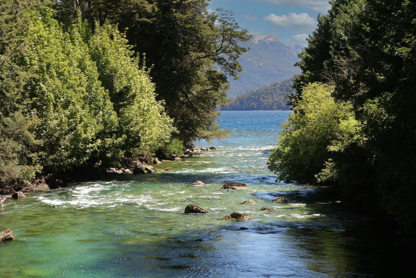
About 3.5 km from the fork in the road, you'll find Lake Correntoso , one of the largest lakes along the route. It has beaches and bays sheltered from the wind, making it a great place for swimming, rowing, or canoeing. You'll then cross the Correntoso River and follow the shoreline of the Última Esperanza arm of Lake Nahuel Huapi.
Junction with Route 231 and Lake Espejo
At kilometer 95 the route splits: to the west it continues as National Route 231 , which leads to the Cardenal Samoré Pass and Chile, and to the north it continues as Route 40 .
Continuing along Route 40, you'll reach Lake Espejo (Mirror Lake) , which owes its name to the reflection of the landscape in its still waters. The viewpoint is a few hundred meters from the intersection, perched on a cliff, and is well worth a stop. The beach can be reached by car via a footpath, and there's a campground nearby. Lake Espejo Chico (Little Mirror Lake), which is another lake, has its own campground with restrooms and showers; check the hours before you go.
Detour to Villa Traful
Between kilometers 112 and 135, there's a turnoff to Villa Traful , a mountain village within Nahuel Huapi National Park , on the shores of Lake Traful. It's reached via Provincial Route 65, a gravel road, and the route can be challenging for low-clearance vehicles. If you have time, it offers cabins, restaurants, tea houses, trekking, horseback riding, and viewpoints overlooking the Lanín Volcano.
On the northern arm of Lake Traful is Pichi Traful beach, very popular in summer. Check the campsite's status before you go.
Hidden Lake
Around kilometer 139 lies Lake Escondido , a small, emerald-green lake surrounded by a forest of coihue trees. It gets its name from being barely visible through the foliage. It's a quick stop for a photo.

From Lago Escondido to San Martín de los Andes (km 139 to 193)
The final stretch encompasses Lakes Villarino, Falkner, Machónico, and finally, Lake Lácar . It is the most open part of the route, with wide valleys and views of the surrounding hills.
Villarino and Falkner
At kilometer 143 are Lakes Villarino and Falkner , which run east-west. Both have beaches perfect for picnics, walks, or simply enjoying the scenery, and are popular spots for trout fishing. If you're looking for more adventure, Mount Buque and Mount Falkner offer opportunities for hiking and climbing.
Vuliñanco Waterfall
Shortly after, around kilometer 146, is the Vuliñanco waterfall . It's easy to visit: there's a large viewpoint where you can park and see the Filuco River cascading down.
Ñivinco Waterfall
The Ñivinco waterfall is a more adventurous hike . The trail winds through a forest of ñire trees and colihue cane and includes wading across a stream , so wear comfortable shoes that can get wet. It's usually located between Villa La Angostura and San Martín, near Pichi Traful; check the trail markers and conditions before you go.
Lanín National Park and Lake Hermoso
Around kilometer 150, you enter Lanín National Park , which protects a significant portion of the Patagonian forests. Near kilometer 155, the turnoff to Lake Hermoso begins, surrounded by lenga and coihue trees and boasting deep, clear waters. From there, you can take walks, horseback rides, or go boating.
Lake Machónico
Around kilometer 160 lies Lake Machónico , one of the smaller lakes but with a very intense blue color. Its name comes from the Mapuche language and is associated with the small shrimp or crabs found among the rocks. There is a viewpoint along the road, and in summer you can kayak or canoe.
Arroyo Partido and Cerro Chapelco
Around kilometer 174, you'll cross the bridge over the Partido stream , known for its waters flowing into both the Pacific and Atlantic Oceans. A few kilometers further on is the access road to Cerro Chapelco , the ski resort of San Martín de los Andes, which offers adventure activities and a viewpoint overlooking Lake Lácar in the summer.
Quila Quina and Lake Lácar
Near the end, the access road to Quila Quina (Route 108, km 12) leads to a Mapuche community on Lake Lácar, with beaches and a rustic campground. It's one of the best natural swimming spots in the area during the summer.
Lake Lácar is the last lake on the route and the lifeblood of San Martín de los Andes , the city where the route ends. It's a destination with stone and wood architecture, chocolate shops, boat trips, mountain biking, horseback riding, fly fishing, and, in winter, skiing and snowboarding at Chapelco .

When to travel to the Seven Lakes Route
The route is open all year round, but each season offers something different:
- Summer (December to March): the best time for swimming, camping, and other activities. December and January are the busiest months and have the highest prices; February and March have fewer tourists, although not all campsites may be open.
- Autumn: reddish and golden colors in the forests, with colder weather and rain.
- Winter (June to August): Snow and skiing at Chapelco, Cerro Bayo, and Catedral. There may be ice on shaded sections and temporary closures due to snow; bring snow chains.
- Spring: more pleasant temperatures, sunny days, and plenty of peace and quiet. October and November are good months for walking.

Where to sleep and camp on the Seven Lakes Route
Regarding the route and its detours, there are options of all kinds:
- Villa La Angostura: hotels, apart hotels and cabins near the main avenue and the hills.
- Free campsites: There are free camping areas without services, such as Villarino and the beach at Lake Espejo. You must bring your own water and take your trash with you.
- Campsites with amenities: According to news reports, options like La Estacada, 7 Lagos, Pichi Traful, and Lago Falkner offer restrooms, showers, and grills. Always confirm schedules, season, and prices with each campsite before you go , as they change every year.
- Villa Traful and San Martín de los Andes: cabins, inns and campsites.
Tips for doing the 7 Lakes Route
- Fill up your fuel tank before leaving Villa La Angostura.
- Check the condition of Route 40 before you start, especially in winter.
- Drive carefully: there are curves, hills and a lot of truck traffic, especially from Chile.
- Do not light fires where it is prohibited, especially in summer.
- Bring warm clothes , even if it's summer: in Patagonia it's windy and gets cool at night.
- Wear shoes that can get wet if you want to visit the Ñivinco waterfall.
- Respect the environment: take your trash with you from the beaches and campsites.
How many kilometers long is the Seven Lakes Route?
The distance between Bariloche and San Martín de los Andes is approximately 190 km. The classic route, between Villa La Angostura and San Martín, is approximately 110 km.
How long does it take to do the 7 Lakes Route?
The classic route can be driven in about 2 hours without stopping, but to enjoy the viewpoints and beaches it is advisable to dedicate a whole day or more.
What are the seven lakes?
Correntoso, Espejo, Escondido, Villarino, Falkner, Machónico, and Lácar, according to the Neuquén Ministry of Tourism. Some sources also include Nahuel Huapi.
What is the best time to do the Seven Lakes Route?
Spring and summer are the most comfortable times. It's possible in winter, but you must carry snow chains and exercise extreme caution. It's not the best time for those without experience driving on mountain roads.
Is it possible to do the Seven Lakes Route in one day?
Yes. There are full-day excursions from Bariloche, and you can do them in your own car with a good pace of stops.
Where can I refuel along the route?
The last gas station before San Martín de los Andes is in El Cruce, in Villa La Angostura. Fill up your tank before leaving.
What about Lakes Meliquina and Lolog?
They are expected to be gradually added to the Seven Lakes Route, with new paved connections. No dates have been confirmed yet.